Gridded mooring data
12-hourly temperature and salinity data used for the calculation of the mid-ocean transport according to Cunningham et al. (2007). The instrument mooring temperature salinity and depth data are merged into five vertical profiles:
- Merged western boundary profiles
- Profiles from western boundary mooring WB3
- Profiles from western boundary mooring WB5
- Western Mid Atlantic Ridge profile
- Eastern Mid Atlantic Ridge profile
- Merged eastern boundary profile
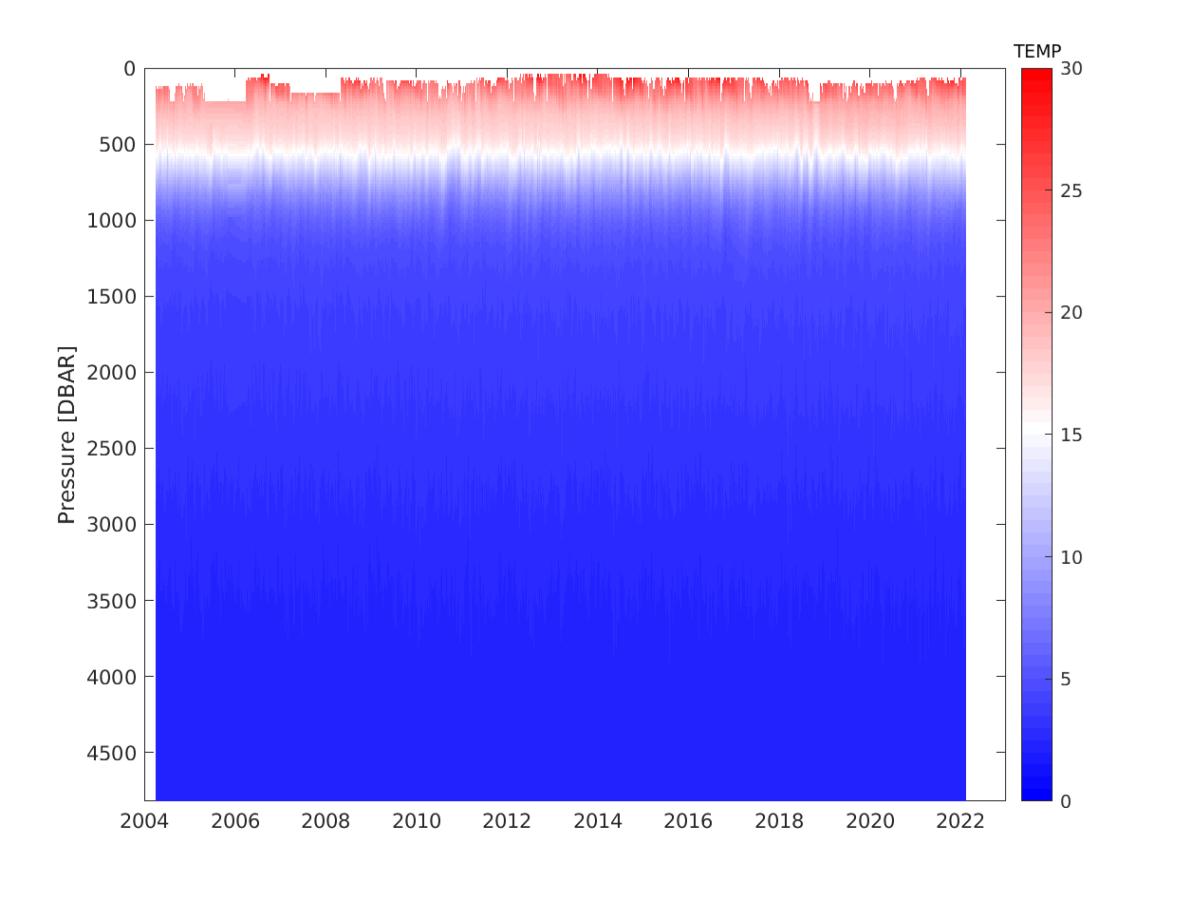
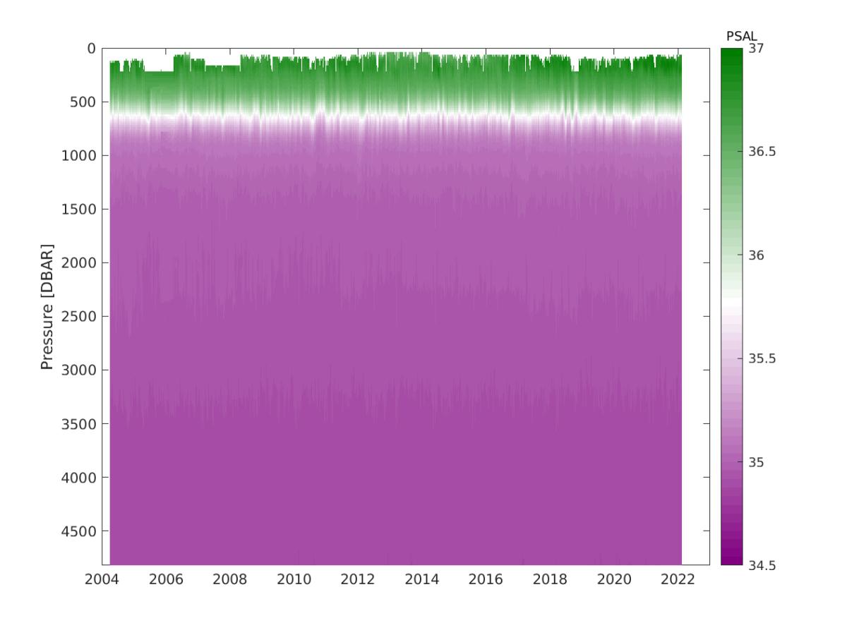
All profiles contain timeseries of 12-hourly temperature and salinity data gridded onto 20m intervals starting in April 2004.
 |
 |
|
Figure 1: Vertical temperature profile in °C (top) and salinity (bottom) at the western boundary from April 2004 to February 2022. |